
内容来源:鸟瞰中国,一点编辑于 2021-07-12 提示:新闻观点不代表本网立场
把祖国的大好河山游遍,这辈子就值了!
美国国家地理纪录片《鸟瞰中国》,航拍大半个中国,震撼壮美!
An opportunity of having a bird’s-eye view of China’s splendid landscapes may only be possible in flight, the documentary Aerial China offers audiences the next best way to enjoy the beauty and geographical diversity of China from high in the sky.
With unique narration and filming methods, the new season of the documentary will offer panoramic views of China’s historical and cultural sights, natural landscapes as well as achievements made in the construction of the country.
本季纪录片选取了浙江、四川、内蒙古、甘肃、广东、福建、江苏等七个省区,将镜头聚焦七省区最具代表性的自然、历史和社会发展等方面的内容,使用无人机、载人机和轨道卫星进行多层次影像呈现,使用VR摄像机在平面影像上进行特效呈现,并采用“一镜到底”场景飞行拍摄等手法,展示中国大美自然景观和丰富多彩的生态环境,彰显经济建设的辉煌成就,揭秘“中国奇迹”背后的创新动力,让世界分享中华文明的博大精深。
长城 Great Wall:

乐山大佛 Leshan Grand Buddha:

元阳梯田 Cultural Landscape of Honghe Hani Rice Terraces:

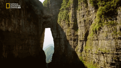
张家界天门山 Tianmen Mountain:
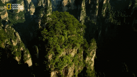
张家界 Zhangjiajie Scenic Area:
川藏公路 SICHUAN-TIBET Highway:


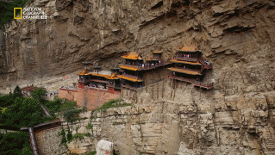
山西悬空寺 Hanging Temple:
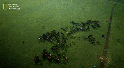
北疆草原:
哈萨克训鹰人:

澜沧江:

点击观看完整视频 Watch the full video by clicking link below:
获取更多地产投资资讯,请登录:marsrealty.co.nz